
Lake Logan topographic map
Interactive map
Click on the map to display elevation.
About this map
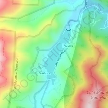
Name: Lake Logan topographic map, elevation, terrain.
Average elevation: 1,040 m
Minimum elevation: 864 m
Maximum elevation: 1,322 m
Other topographic maps
Click on a map to view its topography, its elevation and its terrain.
Lake Logan
United States > North Carolina > Haywood County > Sunburst
Lake Logan, Sunburst, Haywood County, North Carolina, United States
Average elevation: 1,061 m