
El Valle topographic map
Interactive map
Click on the map to display elevation.
About this map
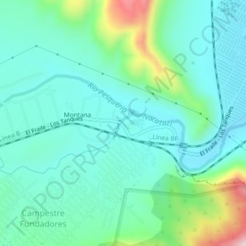
Name: El Valle topographic map, elevation, terrain.
Average elevation: 821 m
Minimum elevation: 740 m
Maximum elevation: 1,103 m
Other topographic maps
Click on a map to view its topography, its elevation and its terrain.
El Fraile
México > Nuevo León > García
El Fraile, García, Nuevo León, 66023, México
Average elevation: 695 m