
Thank you for supporting this site ❤️
Make a donation
Make a donation
Walcheren topographic map
Click on the map to display elevation.
Thank you for supporting this site ❤️
Make a donation
Make a donation
Walcheren
Topographic map of Walcheren, 2015-2016. Click to enlarge.
Thank you for supporting this site ❤️
Make a donation
Make a donation
About this map
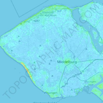
Name: Walcheren topographic map, elevation, terrain.
Location: Walcheren, Zeeland, Netherlands (51.43817 3.43203 51.59506 3.70681)
Average elevation: 0 m
Minimum elevation: -4 m
Maximum elevation: 36 m
Thank you for supporting this site ❤️
Make a donation
Make a donation