
Make a donation
Beaufort topographic map
Click on the map to display elevation.
Make a donation
Beaufort
Beaufort has an elevation-influenced oceanic climate (Köppen: Cfb), with tepid, relatively dry summers and cool, wetter winters. Average maxima vary from 25.3 °C (77.5 °F) in January to 10.1 °C (50.2 °F) in July, while average minima fluctuate between 11.5 °C (52.7 °F) in February and 3.2 °C (37.8 °F) in July. Mean average annual precipitation is moderately low 685.2 mm (26.98 in), but is frequent, spread between 167.1 precipitation days. Consequently, the town is not sunny, experiencing 180.2 cloudy days and only 55.2 clear days annually. Extreme temperatures have ranged from 44.1 °C (111.4 °F) on 7 February 2009 to −6.0 °C (21.2 °F) on 21 July 1982. All climate data was sourced from Ballarat Airport, located 37.2 kilometres (23.1 mi) southeast of Nhill at slightly higher elevation (435 metres (1,427 ft)).
Make a donation
About this map
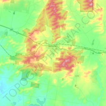
Name: Beaufort topographic map, elevation, terrain.
Location: Beaufort, Shire of Pyrenees, Victoria, 3373, Australia (-37.49550 143.22918 -37.38531 143.43986)
Average elevation: 390 m
Minimum elevation: 323 m
Maximum elevation: 513 m
Make a donation
Other topographic maps
Click on a map to view its topography, its elevation and its terrain.