
Gunung Mas topographic map
Interactive map
Click on the map to display elevation.
About this map
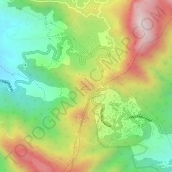
Name: Gunung Mas topographic map, elevation, terrain.
Location: Gunung Mas, Cianjur, West-Java, Indonesien (-6.70533 106.99134 -6.70523 106.99144)
Average elevation: 1,398 m
Minimum elevation: 1,132 m
Maximum elevation: 1,704 m