
Thank you for supporting this site ❤️
Make a donation
Make a donation
Kuchadi topographic map
Click on the map to display elevation.
Thank you for supporting this site ❤️
Make a donation
Make a donation
About this map
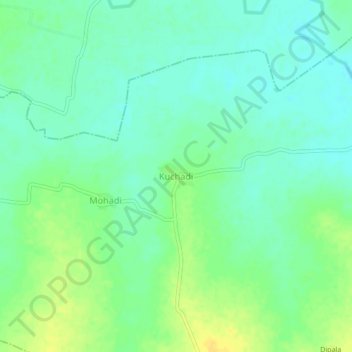
Name: Kuchadi topographic map, elevation, terrain.
Location: Kuchadi, Kuhi Taluka, Nagpur, Maharashtra, India (21.04207 79.20842 21.08207 79.24842)
Average elevation: 274 m
Minimum elevation: 265 m
Maximum elevation: 288 m
Thank you for supporting this site ❤️
Make a donation
Make a donation
Other topographic maps
Click on a map to view its topography, its elevation and its terrain.