
Thank you for supporting this site ❤️
Make a donation
Make a donation
Northfield topographic map
Click on the map to display elevation.
Thank you for supporting this site ❤️
Make a donation
Make a donation
Northfield
According to the United States Census Bureau, the city has an area of 8.61 square miles (22.30 km2); 8.56 square miles (22.17 km2) is land and 0.05 square miles (0.13 km2) is water. The peak elevation is about 912 feet.
Thank you for supporting this site ❤️
Make a donation
Make a donation
About this map
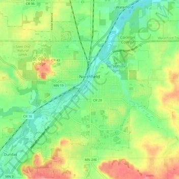
Name: Northfield topographic map, elevation, terrain.
Location: Northfield, Rice County, Minnesota, 55057, United States (44.42084 -93.22144 44.48590 -93.12889)
Average elevation: 300 m
Minimum elevation: 268 m
Maximum elevation: 347 m
Thank you for supporting this site ❤️
Make a donation
Make a donation