
Vellarada topographic map
Interactive map
Click on the map to display elevation.
Vellarada
Vellarada is also known for its hilltop shrine "Kurisumala Pilgrim Centre" (also called Thekkan kurisumala) at an elevation of 640 metres (2,100 ft). Thousands of devotees from various parts of Tamil Nadu, Kerala, Andhra Pradesh and Karnataka visit the shrine during Lent every year.
About this map
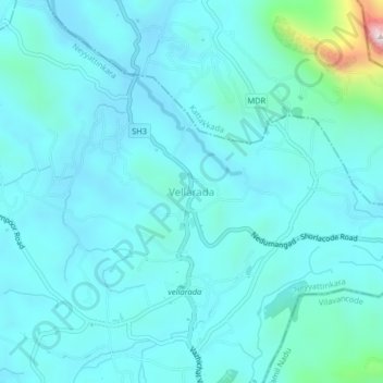
Name: Vellarada topographic map, elevation, terrain.
Average elevation: 139 m
Minimum elevation: 67 m
Maximum elevation: 683 m
Other topographic maps
Click on a map to view its topography, its elevation and its terrain.