
Jardina topographic map
Interactive map
Click on the map to display elevation.
About this map
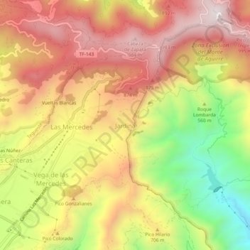
Name: Jardina topographic map, elevation, terrain.
Average elevation: 646 m
Minimum elevation: 166 m
Maximum elevation: 1,012 m
Other topographic maps
Click on a map to view its topography, its elevation and its terrain.
San Matías
Spanien > San Cristóbal de La Laguna
San Matías, San Cristóbal de La Laguna, Santa Cruz de Tenerife, Kanarische Inseln, 38108, Spanien
Average elevation: 251 m
Tejina
Spanien > San Cristóbal de La Laguna
Tejina, San Cristóbal de La Laguna, Santa Cruz de Tenerife, Kanarische Inseln, 38260, Spanien
Average elevation: 198 m
La Cuesta
Spanien > San Cristóbal de La Laguna
La Cuesta, San Cristóbal de La Laguna, Santa Cruz de Tenerife, Kanarische Inseln, 38329, Spanien
Average elevation: 339 m
Chinamada
Spanien > San Cristóbal de La Laguna
Chinamada, San Cristóbal de La Laguna, Santa Cruz de Tenerife, Kanarische Inseln, 38240, Spanien
Average elevation: 320 m