
Thank you for supporting this site ❤️
Make a donation
Make a donation
Three Lakes topographic map
Click on the map to display elevation.
Thank you for supporting this site ❤️
Make a donation
Make a donation
About this map
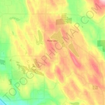
Name: Three Lakes topographic map, elevation, terrain.
Location: Three Lakes, Snohomish County, Washington, United States (47.91213 -122.04499 47.96349 -121.94128)
Average elevation: 138 m
Minimum elevation: -1 m
Maximum elevation: 267 m
Thank you for supporting this site ❤️
Make a donation
Make a donation
Other topographic maps
Click on a map to view its topography, its elevation and its terrain.