
Tlmače topographic map
Interactive map
Click on the map to display elevation.
About this map
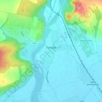
Name: Tlmače topographic map, elevation, terrain.
Average elevation: 192 m
Minimum elevation: 171 m
Maximum elevation: 269 m
The town lies at an altitude of 175 metres and covers an area of 4,642 km2 (1,792 sq mi). It has a population of about 3,500 people.
Other topographic maps
Click on a map to view its topography, its elevation and its terrain.
Veselá
Slovakia > Region of Nitra > District of Levice > Šarovce
Veselá, Šarovce, District of Levice, Region of Nitra, Western Slovakia, Slovakia
Average elevation: 149 m
Šahy
Slovakia > Region of Nitra > District of Levice
Šahy, District of Levice, Region of Nitra, Western Slovakia, 936 01, Slovakia
Average elevation: 179 m
Pastovce
Slovakia > Region of Nitra > District of Levice
Pastovce, District of Levice, Region of Nitra, Western Slovakia, Slovakia
Average elevation: 135 m