
Thank you for supporting this site ❤️
Make a donation
Make a donation
Schwendt topographic map
Click on the map to display elevation.
Thank you for supporting this site ❤️
Make a donation
Make a donation
About this map
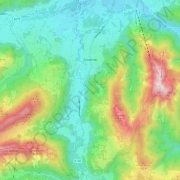
Name: Schwendt topographic map, elevation, terrain.
Location: Schwendt, Bezirk Kitzbühel, 6385, Austria (47.58594 12.32041 47.65149 12.43646)
Average elevation: 948 m
Minimum elevation: 582 m
Maximum elevation: 1,733 m
Thank you for supporting this site ❤️
Make a donation
Make a donation