
Weggis topographic map
Interactive map
Click on the map to display elevation.
About this map
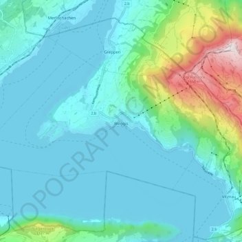
Name: Weggis topographic map, elevation, terrain.
Location: Weggis, Lucerna, Svizzera (47.01133 8.36850 47.05469 8.48043)
Average elevation: 631 m
Minimum elevation: 424 m
Maximum elevation: 1,791 m