
Thank you for supporting this site ❤️
Make a donation
Make a donation
Yavatmal topographic map
Click on the map to display elevation.
Thank you for supporting this site ❤️
Make a donation
Make a donation
About this map
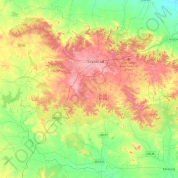
Name: Yavatmal topographic map, elevation, terrain.
Location: Yavatmal, Maharashtra, India (20.13374 77.94896 20.51872 78.38702)
Average elevation: 340 m
Minimum elevation: 242 m
Maximum elevation: 486 m
Thank you for supporting this site ❤️
Make a donation
Make a donation
Other topographic maps
Click on a map to view its topography, its elevation and its terrain.