
Grad Dubrovnik topographic map
Interactive map
Click on the map to display elevation.
About this map
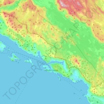
Name: Grad Dubrovnik topographic map, elevation, terrain.
Location: Grad Dubrovnik, Comitat de Dubrovnik-Neretva, Croatie (42.62089 17.76559 42.78046 18.16260)
Average elevation: 296 m
Minimum elevation: -1 m
Maximum elevation: 1,386 m