
Zehlendorf topographic map
Interactive map
Click on the map to display elevation.
About this map
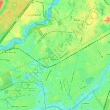
Name: Zehlendorf topographic map, elevation, terrain.
Location: Zehlendorf, Steglitz-Zehlendorf, Berlin, Deutschland (52.40423 13.21788 52.46919 13.28311)
Average elevation: 48 m
Minimum elevation: 31 m
Maximum elevation: 72 m