
Wängi topographic map
Interactive map
Click on the map to display elevation.
About this map
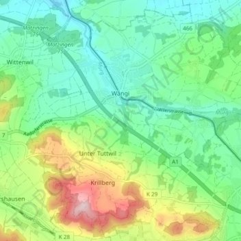
Name: Wängi topographic map, elevation, terrain.
Location: Wängi, Bezirk Münchwilen, Thurgau, Schweiz (47.46772 8.92195 47.51410 8.99634)
Average elevation: 534 m
Minimum elevation: 448 m
Maximum elevation: 726 m