
FELDA Chemomoi topographic map
Interactive map
Click on the map to display elevation.
About this map
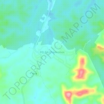
Name: FELDA Chemomoi topographic map, elevation, terrain.
Location: FELDA Chemomoi, Bentong, Pahang, 28310, Malaysia (3.22541 102.22642 3.26541 102.26642)
Average elevation: 78 m
Minimum elevation: 46 m
Maximum elevation: 195 m