
Thank you for supporting this site ❤️
Make a donation
Make a donation
Amberg topographic map
Click on the map to display elevation.
Thank you for supporting this site ❤️
Make a donation
Make a donation
About this map
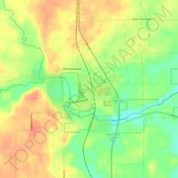
Name: Amberg topographic map, elevation, terrain.
Average elevation: 277 m
Minimum elevation: 249 m
Maximum elevation: 299 m
Thank you for supporting this site ❤️
Make a donation
Make a donation
Other topographic maps
Click on a map to view its topography, its elevation and its terrain.
Thank you for supporting this site ❤️
Make a donation
Make a donation
Menominee River State Recreation Area- Pemene Falls Unit
United States > Wisconsin > Marinette County
Average elevation: 250 m
Menominee River State Recreation Area- Quiver Falls Unit
United States > Wisconsin > Marinette County
Average elevation: 267 m
Thank you for supporting this site ❤️
Make a donation
Make a donation