
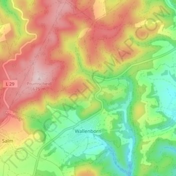
Wallenborn topographic map
Interactive map
Click on the map to display elevation.
About this map
Name: Wallenborn topographic map, elevation, terrain.
Average elevation: 529 m
Minimum elevation: 394 m
Maximum elevation: 678 m
Other topographic maps
Click on a map to view its topography, its elevation and its terrain.
Holzmaar
Deutschland > Rheinland-Pfalz > Landkreis Vulkaneifel > Gillenfeld
Holzmaar, Gillenfeld, Daun, Landkreis Vulkaneifel, Rheinland-Pfalz, 54558, Deutschland
Average elevation: 442 m
Schönbach
Deutschland > Rheinland-Pfalz > Landkreis Vulkaneifel
Schönbach, Daun, Landkreis Vulkaneifel, Rheinland-Pfalz, Deutschland
Average elevation: 442 m