
Antakya topographic map
Interactive map
Click on the map to display elevation.
About this map
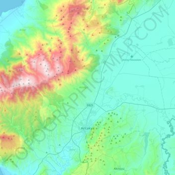
Name: Antakya topographic map, elevation, terrain.
Location: Antakya, Hatay, Mediterranean Region, Turkey (36.16188 35.92274 36.42382 36.40043)
Average elevation: 384 m
Minimum elevation: 0 m
Maximum elevation: 1,793 m
The city experiences a hot-summer Mediterranean climate (Köppen climate classification Csa) with hot and dry summers, and mild and wet winters; however due to its higher altitude, Antakya has slightly cooler temperatures than the coast.
Other topographic maps
Click on a map to view its topography, its elevation and its terrain.