
Thank you for supporting this site ❤️
Make a donation
Make a donation
Jizzakh Region topographic map
Click on the map to display elevation.
Thank you for supporting this site ❤️
Make a donation
Make a donation
About this map
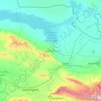
Name: Jizzakh Region topographic map, elevation, terrain.
Location: Jizzakh Region, Uzbekistan (39.52999 66.64336 41.18204 69.02410)
Average elevation: 644 m
Minimum elevation: 238 m
Maximum elevation: 4,201 m
Thank you for supporting this site ❤️
Make a donation
Make a donation
Other topographic maps
Click on a map to view its topography, its elevation and its terrain.
Thank you for supporting this site ❤️
Make a donation
Make a donation
Thank you for supporting this site ❤️
Make a donation
Make a donation
Jizzax
From the slopes of the mountains at an altitude of 1800 meters above sea level, pine forests begin. As the mountains rise, the pine forest thickens.
Average elevation: 381 m
Thank you for supporting this site ❤️
Make a donation
Make a donation