
Thank you for supporting this site ❤️
Make a donation
Make a donation
Distrito David topographic map
Click on the map to display elevation.
Thank you for supporting this site ❤️
Make a donation
Make a donation
About this map
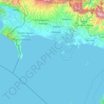
Name: Distrito David topographic map, elevation, terrain.
Location: Distrito David, Chiriquí, Panama (7.46329 -82.55959 8.77027 -82.20538)
Average elevation: 156 m
Minimum elevation: -1 m
Maximum elevation: 2,478 m
Thank you for supporting this site ❤️
Make a donation
Make a donation