
Thank you for supporting this site ❤️
Make a donation
Make a donation
Agrigento topographic map
Click on the map to display elevation.
Thank you for supporting this site ❤️
Make a donation
Make a donation
About this map
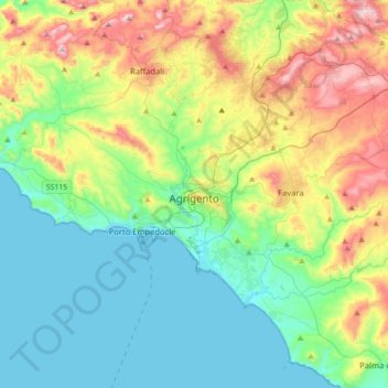
Name: Agrigento topographic map, elevation, terrain.
Location: Agrigento, Sicily, 92100, Italy (37.18968 13.39665 37.44064 13.74862)
Average elevation: 191 m
Minimum elevation: 0 m
Maximum elevation: 652 m
Thank you for supporting this site ❤️
Make a donation
Make a donation