
Thank you for supporting this site ❤️
Make a donation
Make a donation
La Borderie topographic map
Click on the map to display elevation.
Thank you for supporting this site ❤️
Make a donation
Make a donation
About this map
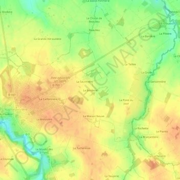
Name: La Borderie topographic map, elevation, terrain.
Average elevation: 47 m
Minimum elevation: 21 m
Maximum elevation: 62 m
Thank you for supporting this site ❤️
Make a donation
Make a donation
Other topographic maps
Click on a map to view its topography, its elevation and its terrain.
85620
France > Pays de la Loire > Vendée > Rocheservière > Moulin de la Roche Boulogne
Average elevation: 48 m