
Brule Lake topographic map
Interactive map
Click on the map to display elevation.
About this map
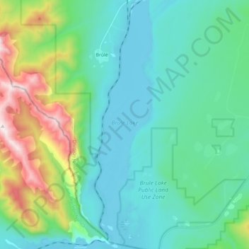
Name: Brule Lake topographic map, elevation, terrain.
Location: Brule Lake, Brûlé, Yellowhead County, Alberta, Canada (53.22843 -117.87218 53.33326 -117.83356)
Average elevation: 1,250 m
Minimum elevation: 980 m
Maximum elevation: 2,229 m