
Ozourguéti topographic map
Interactive map
Click on the map to display elevation.
About this map
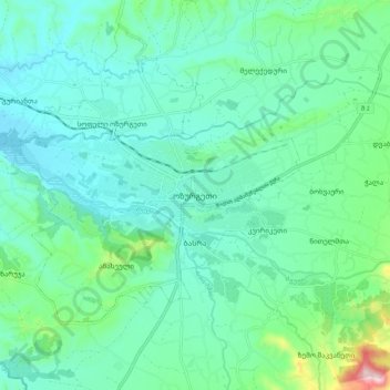
Name: Ozourguéti topographic map, elevation, terrain.
Location: Ozourguéti, ოზურგეთი, Gourie, Géorgie (41.88310 41.96593 41.96310 42.04593)
Average elevation: 104 m
Minimum elevation: 40 m
Maximum elevation: 366 m