
Tarm topographic map
Interactive map
Click on the map to display elevation.
About this map
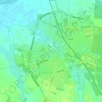
Name: Tarm topographic map, elevation, terrain.
Location: Tarm, Ringkøbing-Skjern Kommune, Region Mitteljütland, Dänemark (55.89647 8.49753 55.91641 8.53725)
Average elevation: 7 m
Minimum elevation: -1 m
Maximum elevation: 13 m