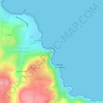
Fort d'Omonville-Bas topographic map
Interactive map
Click on the map to display elevation.
About this map
Name: Fort d'Omonville-Bas topographic map, elevation, terrain.
Average elevation: 25 m
Minimum elevation: 0 m
Maximum elevation: 116 m

Click on the map to display elevation.
Name: Fort d'Omonville-Bas topographic map, elevation, terrain.
Average elevation: 25 m
Minimum elevation: 0 m
Maximum elevation: 116 m