
Thank you for supporting this site ❤️
Make a donation
Make a donation
Kellits topographic map
Click on the map to display elevation.
Thank you for supporting this site ❤️
Make a donation
Make a donation
About this map
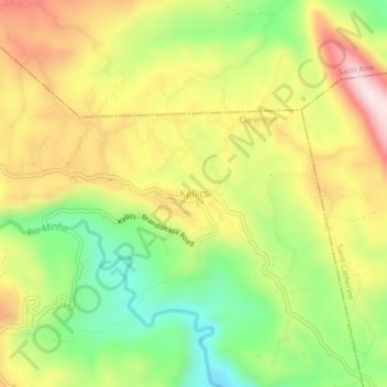
Name: Kellits topographic map, elevation, terrain.
Location: Kellits, Clarendon, Middlesex County, Jamaica (18.15290 -77.25097 18.19290 -77.21097)
Average elevation: 530 m
Minimum elevation: 313 m
Maximum elevation: 766 m
Thank you for supporting this site ❤️
Make a donation
Make a donation
Other topographic maps
Click on a map to view its topography, its elevation and its terrain.