
Bahri topographic map
Interactive map
Click on the map to display elevation.
About this map
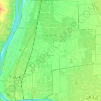
Name: Bahri topographic map, elevation, terrain.
Location: Bahri, Khartoum State, Sudan (15.61560 32.50734 15.74897 32.64175)
Average elevation: 385 m
Minimum elevation: 371 m
Maximum elevation: 441 m
Other topographic maps
Click on a map to view its topography, its elevation and its terrain.
Khartoum
Sudan > Khartoum State > Khartoum
Khartoum is relatively flat, at elevation 385 m (1,263 ft), as the Nile flows northeast past Omdurman to Shendi, at elevation 364 m (1,194 ft)about 101 miles (163 km) away.
Average elevation: 388 m