
Gemeinde Nesselwängle topographic map
Interactive map
Click on the map to display elevation.
About this map
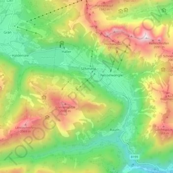
Name: Gemeinde Nesselwängle topographic map, elevation, terrain.
Location: Gemeinde Nesselwängle, Bezirk Reutte, Tirol, 6672, Österreich (47.45305 10.54441 47.50834 10.64000)
Average elevation: 1,439 m
Minimum elevation: 907 m
Maximum elevation: 2,221 m