
Daïra Bir Mourad Rais topographic map
Interactive map
Click on the map to display elevation.
About this map
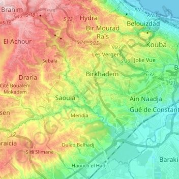
Name: Daïra Bir Mourad Rais topographic map, elevation, terrain.
Location: Daïra Bir Mourad Rais, Alger, RADP (36.65716 3.00158 36.75709 3.11485)
Average elevation: 115 m
Minimum elevation: -1 m
Maximum elevation: 283 m
Other topographic maps
Click on a map to view its topography, its elevation and its terrain.