
Thunersee topographic map
Interactive map
Click on the map to display elevation.
Thunersee
Der maximale Abfluss ohne Stollen beträgt 345 m³ pro Sekunde, der mittlere Abfluss liegt bei 110 m³/s. Sein Hauptzufluss, die Aare, wird im Südosten vom 6 Meter höhergelegenen Brienzersee gespeist.
About this map
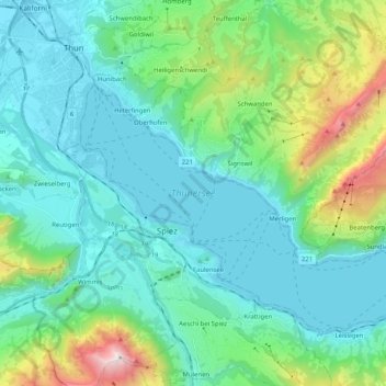
Name: Thunersee topographic map, elevation, terrain.
Average elevation: 899 m
Minimum elevation: 545 m
Maximum elevation: 2,351 m