
kolukhet topographic map
Interactive map
Click on the map to display elevation.
About this map
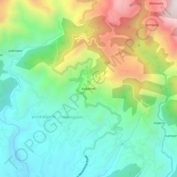
Name: kolukhet topographic map, elevation, terrain.
Location: kolukhet, salangaon, Dehradun, Uttarakhand, 248129, India (30.39619 78.05951 30.43619 78.09951)
Average elevation: 1,186 m
Minimum elevation: 826 m
Maximum elevation: 1,900 m