
Lützen topographic map
Interactive map
Click on the map to display elevation.
About this map
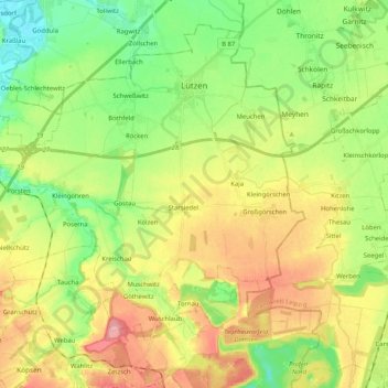
Name: Lützen topographic map, elevation, terrain.
Location: Lützen, Burgenlandkreis, Sachsen-Anhalt, 06686, Alemanha (51.16631 11.99926 51.27909 12.20483)
Average elevation: 135 m
Minimum elevation: 89 m
Maximum elevation: 197 m