
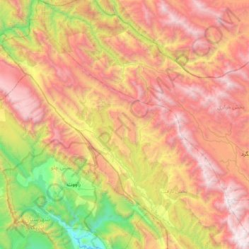
دهستان بازفت بالا topographic map
Interactive map
Click on the map to display elevation.
About this map
Name: دهستان بازفت بالا topographic map, elevation, terrain.
Average elevation: 2,250 m
Minimum elevation: 507 m
Maximum elevation: 4,153 m
Other topographic maps
Click on a map to view its topography, its elevation and its terrain.
Bazoft
Iran > Chaharmahal and Bakhtiyari Province > Kuhrang County
Bazoft, بخش بازفت, Kuhrang County, Chaharmahal and Bakhtiyari Province, 88691-80537, Iran
Average elevation: 1,569 m