
Dietges topographic map
Interactive map
Click on the map to display elevation.
About this map
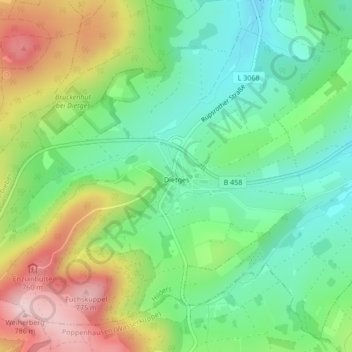
Name: Dietges topographic map, elevation, terrain.
Location: Dietges, Hilders, Landkreis Fulda, Hesse, Alemanha (50.51774 9.90549 50.54053 9.94621)
Average elevation: 619 m
Minimum elevation: 522 m
Maximum elevation: 780 m
Other topographic maps
Click on a map to view its topography, its elevation and its terrain.
Ehrenberg (Rhön)
Alemanha > Hesse > Landkreis Fulda
Ehrenberg (Rhön), Landkreis Fulda, Hesse, Alemanha
Average elevation: 708 m