
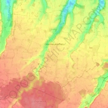
Oberneukirchen topographic map
Interactive map
Click on the map to display elevation.
About this map
Name: Oberneukirchen topographic map, elevation, terrain.
Average elevation: 463 m
Minimum elevation: 416 m
Maximum elevation: 489 m
Other topographic maps
Click on a map to view its topography, its elevation and its terrain.
Elsenbach
Duitsland > Beieren > Landkreis Mühldorf am Inn > Neumarkt-Sankt Veit
Elsenbach, Neumarkt-Sankt Veit, Neumarkt-Sankt Veit (VGem), Landkreis Mühldorf am Inn, Beieren, 84546, Duitsland
Average elevation: 472 m