
Gollapally topographic map
Interactive map
Click on the map to display elevation.
About this map
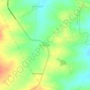
Name: Gollapally topographic map, elevation, terrain.
Location: Gollapally, Chevella mandal, Rangareddy, Telangana, India (17.34019 78.14643 17.38019 78.18643)
Average elevation: 609 m
Minimum elevation: 585 m
Maximum elevation: 638 m
Other topographic maps
Click on a map to view its topography, its elevation and its terrain.
Gollapally
India > Telangana > Gollapally
Gollapally, Jagdevpur mandal, Siddipet, Telangana, 502311, India
Average elevation: 560 m