
Merchtem topographic map
Interactive map
Click on the map to display elevation.
About this map
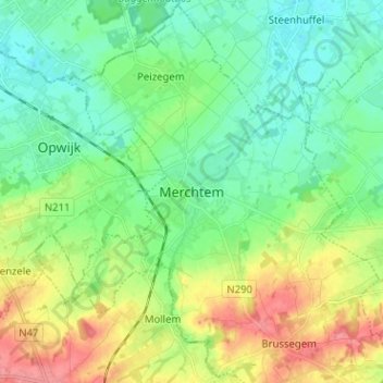
Name: Merchtem topographic map, elevation, terrain.
Location: Merchtem, Hal-Vilvorde, Brabant flamand, Flandre, 1785, Belgique (50.91936 4.19357 50.99936 4.27357)
Average elevation: 33 m
Minimum elevation: 8 m
Maximum elevation: 81 m