
Thank you for supporting this site ❤️
Make a donation
Make a donation
Painesville topographic map
Click on the map to display elevation.
Thank you for supporting this site ❤️
Make a donation
Make a donation
About this map
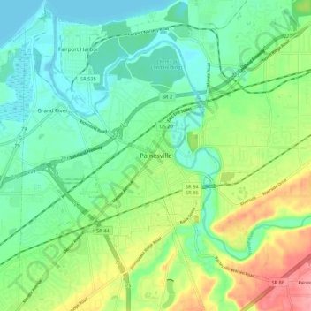
Name: Painesville topographic map, elevation, terrain.
Location: Painesville, Lake County, Ohio, 44077, United States (41.68449 -81.28566 41.76449 -81.20566)
Average elevation: 203 m
Minimum elevation: 172 m
Maximum elevation: 268 m
Thank you for supporting this site ❤️
Make a donation
Make a donation