
Lago topographic map
Interactive map
Click on the map to display elevation.
About this map
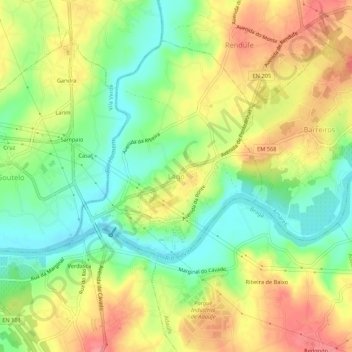
Name: Lago topographic map, elevation, terrain.
Location: Lago, Amares, Braga, 4720-546, Portugal (41.59260 -8.43739 41.63260 -8.39739)
Average elevation: 58 m
Minimum elevation: 20 m
Maximum elevation: 98 m