
Madhugiri topographic map
Interactive map
Click on the map to display elevation.
About this map
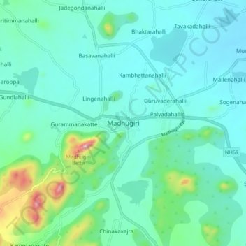
Name: Madhugiri topographic map, elevation, terrain.
Average elevation: 783 m
Minimum elevation: 702 m
Maximum elevation: 1,166 m
At 3,930 ft (1,200 m) elevation, Madhugiri is a single hill. Nestled on its steep slopes is a fort. Antaralada Bagilu, Diddi Bagilu, and Mysuru Gate are the three gateways of the fort. A series of doorways leads to the hill. The ruined temple of Gopalakrishna is located at the top.