
Valtournenche topographic map
Interactive map
Click on the map to display elevation.
About this map
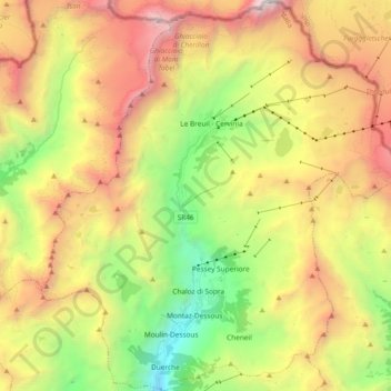
Name: Valtournenche topographic map, elevation, terrain.
Location: Valtournenche, Vallée d'Aoste, Italie (45.84648 7.54885 45.97664 7.73489)
Average elevation: 2,640 m
Minimum elevation: 1,234 m
Maximum elevation: 4,349 m
Other topographic maps
Click on a map to view its topography, its elevation and its terrain.
Chatelar
Italie > Vallée d'Aoste > Valtournenche > Chatelar
Chatelar, Valtournenche, Vallée d'Aoste, 11028, Italie
Average elevation: 1,890 m