

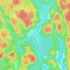
Harcourt topographic map
Click on the map to display elevation.
About this map

Name: Harcourt topographic map, elevation, terrain.
Average elevation: 413 m
Minimum elevation: 355 m
Maximum elevation: 471 m
Other topographic maps
Click on a map to view its topography, its elevation and its terrain.


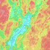


Gooderham Lake
Canada > Ontario > Haliburton County > Highlands East > Gooderham
Average elevation: 344 m


Fort Irwin Conservation Area Trail Head
Canada > Ontario > Haliburton County > Dysart et al
Average elevation: 391 m






Oxtongue Lake
Canada > Ontario > Haliburton County > Algonquin Highlands > Oxtongue Lake
Average elevation: 394 m


Gooderham Lake Dam
Canada > Ontario > Haliburton County > Highlands East > Gooderham
Average elevation: 339 m


