
Thank you for supporting this site ❤️
Make a donation
Make a donation
Bellville topographic map
Click on the map to display elevation.
Thank you for supporting this site ❤️
Make a donation
Make a donation
About this map
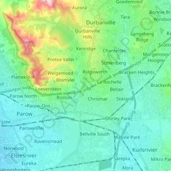
Name: Bellville topographic map, elevation, terrain.
Location: Bellville, City of Cape Town, Western Cape, South Africa (-33.94120 18.57766 -33.82513 18.67774)
Average elevation: 115 m
Minimum elevation: 28 m
Maximum elevation: 461 m
Thank you for supporting this site ❤️
Make a donation
Make a donation
Other topographic maps
Click on a map to view its topography, its elevation and its terrain.