
Munneru River topographic map
Interactive map
Click on the map to display elevation.
About this map
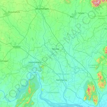
Name: Munneru River topographic map, elevation, terrain.
Location: Munneru River, Vatsavai, NTR District, Andhra Pradesh, India (16.59331 80.12207 17.30416 80.33019)
Average elevation: 94 m
Minimum elevation: 19 m
Maximum elevation: 671 m
Other topographic maps
Click on a map to view its topography, its elevation and its terrain.
Chityala
India > Andhra Pradesh > Vatsavai
Chityala, Vatsavai, NTR, Andhra Pradesh, 521193, India
Average elevation: 72 m