
Thank you for supporting this site ❤️
Make a donation
Make a donation
Garrison topographic map
Click on the map to display elevation.
Thank you for supporting this site ❤️
Make a donation
Make a donation
About this map
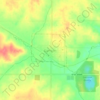
Name: Garrison topographic map, elevation, terrain.
Location: Garrison, Benton County, Iowa, United States (42.13992 -92.15095 42.14875 -92.13818)
Average elevation: 274 m
Minimum elevation: 239 m
Maximum elevation: 305 m
Thank you for supporting this site ❤️
Make a donation
Make a donation