
Obertraun topographic map
Interactive map
Click on the map to display elevation.
About this map
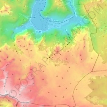
Name: Obertraun topographic map, elevation, terrain.
Location: Obertraun, Bezirk Gmunden, Opper-Oostenrijk, 4831, Oostenrijk (47.46111 13.60875 47.58154 13.76067)
Average elevation: 1,629 m
Minimum elevation: 501 m
Maximum elevation: 2,903 m
Other topographic maps
Click on a map to view its topography, its elevation and its terrain.
Tauern
Oostenrijk > Opper-Oostenrijk > Bezirk Gmunden > Bad Ischl
Tauern, Bad Ischl, Bezirk Gmunden, Opper-Oostenrijk, 4820, Oostenrijk
Average elevation: 1,041 m